S
640 x 427 px
FREE
M
1920 x 1280 px
FREE
L
5327 x 3551 px
FREE
Upgrade to download up to 10 images at a time.
Standard license
This Streets of Joto Ward, Osaka City photo can be used for personal projects. It can also be used for commercial projects in some cases. Read more
Image information
Creatore:のにっしー
Title: Streets of Joto Ward, Osaka City
Image ID: 29763608
Downloads: 0
Model release: N/A
Property release: N/A
Categories:
edifici--architettura / Streets of Joto Ward, Osaka City

0
Share
Like
Antivirus
S
640 x 427 px
FREE
M
1920 x 1280 px
FREE
L
5327 x 3551 px
FREE
Upgrade to download up to 10 images at a time.
Standard license
This Streets of Joto Ward, Osaka City photo can be used for personal projects. It can also be used for commercial projects in some cases. Read more
Image information
Creatore:のにっしー
Title: Streets of Joto Ward, Osaka City
Image ID: 29763608
Downloads: 0
Model release: N/A
Property release: N/A
Categories:
edifici--architettura / Streets of Joto Ward, Osaka City
Similar free stock photos
View all
Similar free illustrations
View all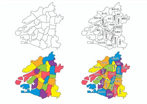


Similar free illustrations
View all Comments
Login or Sign Up to leave a comment